Sharing some ideas around how the Geo Web parcel grid can evolve over time and eventually support polygons.
2 Likes
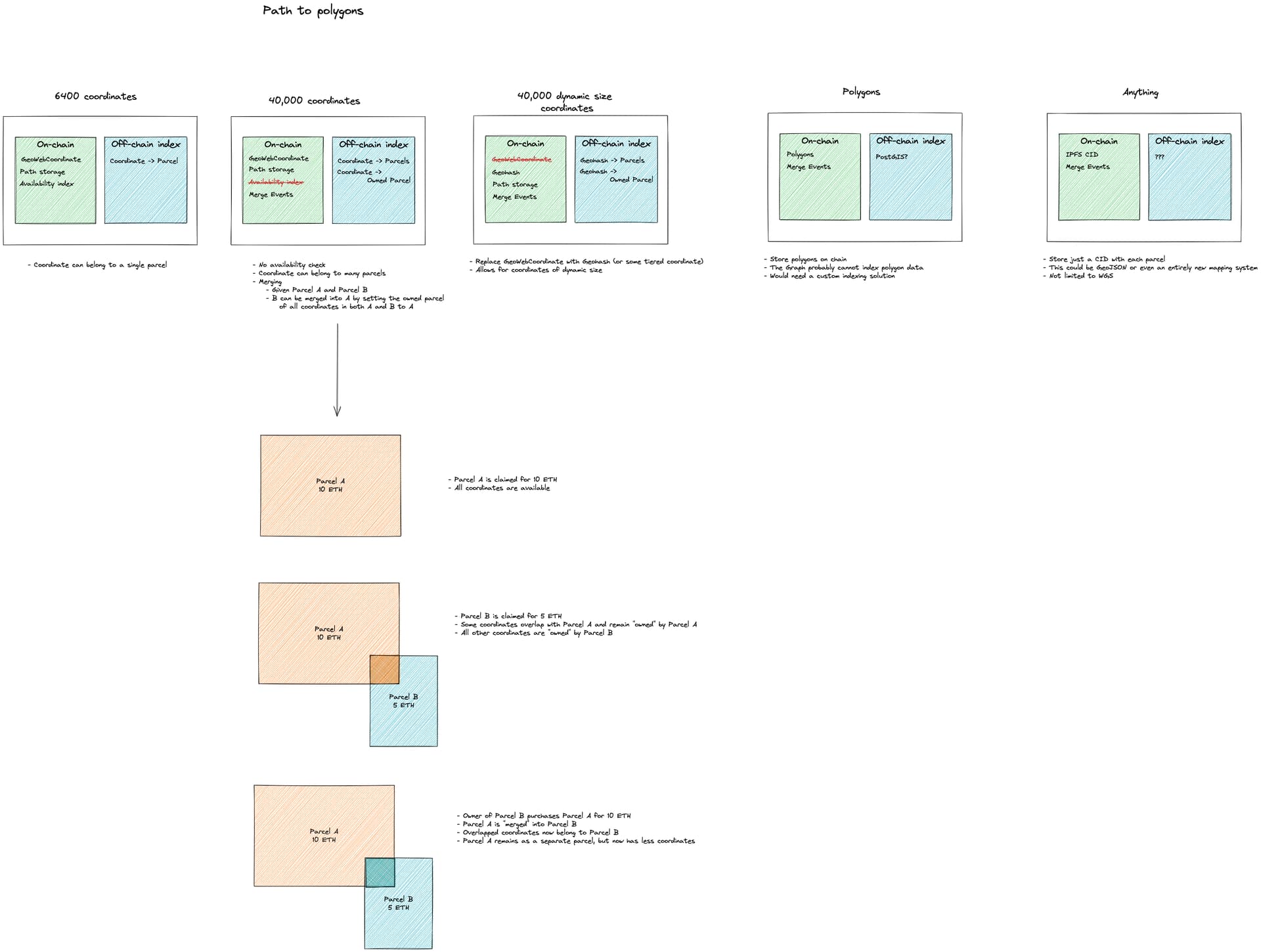
Sorry, just getting to this now. What I mean is that different parcels could have a different size class of coordinates. If using a hierarchical system like Geohash, for example, each parcel could select one Geohash size.
This would allow a large parcel to sacrifice granularity for a larger maximum size, or a small parcel to sacrifice a large maximum size for more granularity.